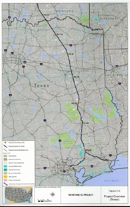
Area residents can find information at public libraries about a proposed pipeline designed to carry oil through North Texas.
The Keystone XL Pipeline is a TransCanada Corporation project that will deliver crude oil from the Athabasca Oil Sands in northeastern Alberta, Canada to refineries in Illinois and Oklahoma before the pipeline heads south to the Gulf Coast at Port Arthur, Texas.
The proposed pipeline would traverse Montana, South Dakota, Nebraska, Oklahoma, and Texas, with localized facilities constructed on an existing segment of pipeline in Kansas. A tank farm is planned for Cushing, Oklahoma. From Cushing, the pipeline would continue south, clipping the northeast corner of Fannin County, Texas and dissect Lamar County, Texas.

The pipeline has the capacity to transport 700,000 barrels per day.
As with any project of this scope, environmental concerns have been debated, primarily in regard to the pipeline passing over the Ogallala Aquifer, the primary source of drinking water for 2 million people as well as the primary source of irrigation for an agricultural region vital to the nation's food supply.
The public is invited to examine the proposed project's Environmental Impact Study at a number of public libraries including Bonham Public Library, Paris Public Library, Sulphur Springs Public Library and the Robert. L. Williams Public Library in Durant.
The Environmental Impact Study describes the proposed project and alternatives to the proposed project, the potential impacts of construction and normal operation of the proposed project and alternatives, cumulative impacts, the agency-preferred alternative, and issues related to potential spills from the proposed project.