Editor's note: This article was originally published in North Texas e-News May 18, 2005.
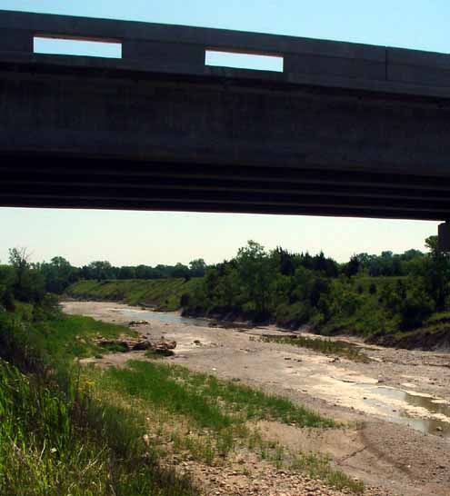
Picture the Hwy 34 bridge over North Sulphur River between Ladonia and Honey Grove. Now picture it 40 feet underwater.
That is how much Lake Ralph Hall would alter the landscape in southeastern Fannin County. While any decision of this magnitude will generate strong feelings in different camps, early indications are there won't be any major archeological sites disturbed and no particularly unique habitat would be endangered if the proposed lake is built in these rolling hills that can go from open pasture to creeks lined with red cedar, big bois d' arc trees and honey locust thickets.
That was some of the information being tossed about Tuesday as North Texas media, Ladonia city officials, representatives of Upper Trinity Regional Water District and a group of landowners in support of Lake Ralph Hall toured the site of this proposed 11,200-acre lake. This lake would displace 16 houses. No cemeteries would be affected and no major pipelines traverse the area. The most probable timeline would have the lake finished between 2016-2022.
Upper Trinity made available some of the information gleaned over as surveyors, biologists and an archeologist began turning in preliminary studies from the site. The bottom line so far? No surprises.
Environmental scientist Jason Voight gave a walking tour of an area that would be the south shore of the proposed lake, pointing out the native trees and grasses that are common to Fannin County. Voight said that aerial views and on-foot excursions have turned up no "critical habitat" that an inpoundment would disturb. Ladonia Mayor Leon Hurse and Ladonia Mayor Pro-Tem Lyndal Burnett came along to get this latest information first-hand.
This group of landowners, including Jerry Lane, Gary Erwin and Mr. Burnett view the lake as inevitable and all have mixed emotions about flooding the bottomland along the North Sulphur River.
"It ain't gonna be cheap when you come around here," Lane says about giving up a large spread he humorously describes as "a couple hundred acres bigger than George W's place."
Land prices have already doubled around Ladonia as people speculate about the possibility of a lake, the mayor points out.
Staff archeologist Dr. Allan Skinner briefed the tour at the next location. The North Sulphur watershed has always been popular with arrowhead hunters and Skinner says that while a search of the riverbed might turn up an artifact that dates back to 10,000 B.C., it is out of context, having washed in from other locations. Skinner said his goal is to find what is in the area of the proposed lake -- particularly Indian campsites.
"We are not seeing anything that is a project-stopper," Skinner observed.

Tuesday's three-hour tour started on what would be the south shore of Lake Ralph Hall.
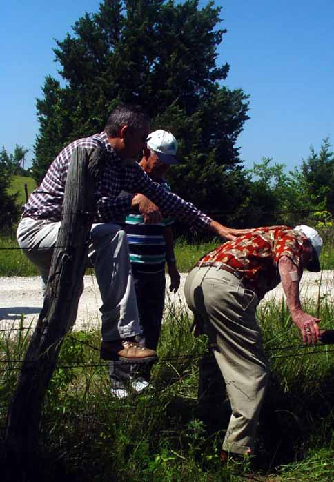
Members of the tour assist Ladonia Mayer Leon Hurse through a fence.
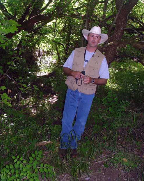
Evironmental scientist Jason Voight said no "critical habitat" would be threatened by the lake.
Landowner Gary Erwin listens to Voight's analysis.

This bridge would be 40 feet underwater if the lake were to be built.

Upper Trinity representatives Larry Patterson (left) and Ed Motley utilize a large map during the discussion.

Current plans call for a much taller bridge to cross the lake at this location.

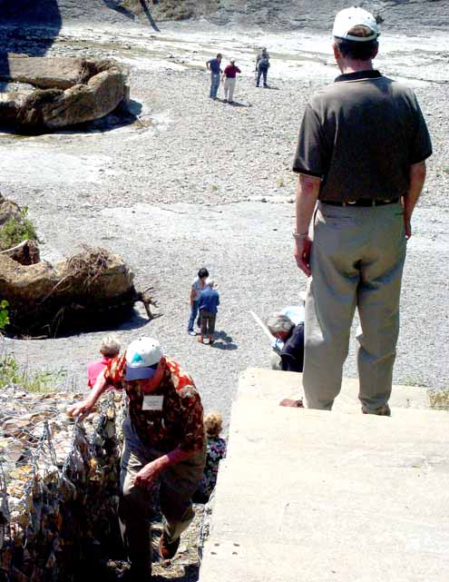
Mayor Hurse climbs back to the top after touring the river bottom.
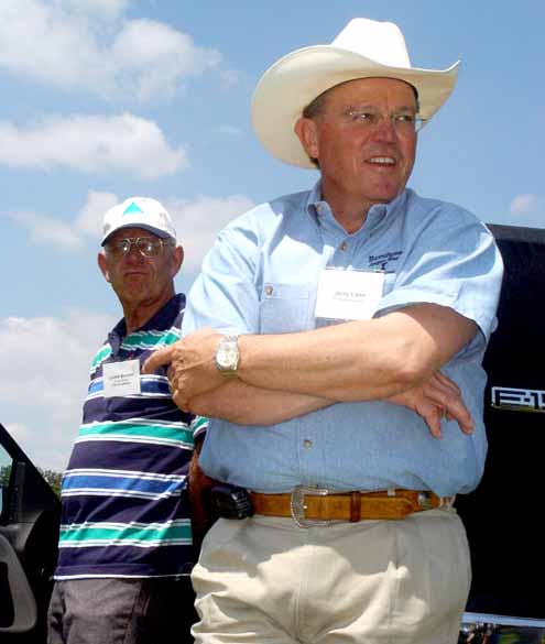
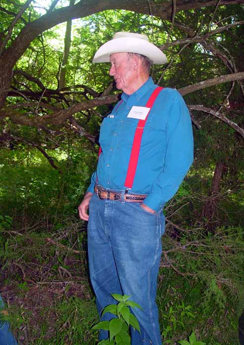
Landowners Lyndal Burnett (left) and Jerry Lane feel the lake is inevitable. "But it ain't gonna be cheap," Lane says when asked about giving up fertile bottom land.

"We are not seeing anything that is a project-stopper," staff archeologist Dr. Allan Skinner told the group.
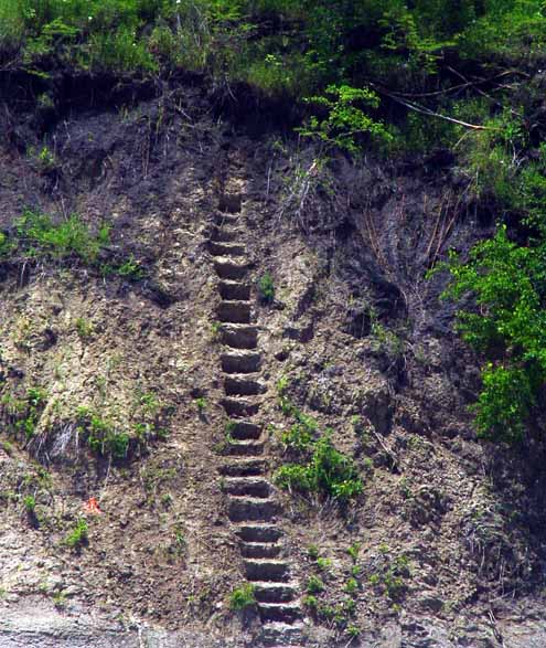
Steps in time...these "steps" are actually chronological soil samples that indicate the valley along North Sulphur River began to fill with layers of silt approximately 17,000 years ago.