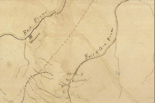
Fannin County, Texas -- A remarkable map from 1840 shows "Englishes" on the banks of the Bois d'Arc River. This map is held by the Texas General Land Office. The "Englishes" depicted on the map is of course Fort Inglish, established by Bailey Inglish in 1837-38. This map may be the first time "Fort Inglish" is depicted on a map. The segment below is just a very small part of a very large map. The story of the map is told below.
In 1838, the Legislature of the new Republic of Texas passed a law for the establishment of a military road from Austin to the Red River.
In 1840, Colonel William Gordon Cooke and his soldiers set off from Austin. The route continued to Waco Village and then north.
As related in Colonel’s Cooke’s November 14, 1840 report to the Secretary of War of the Republic of Texas, he had planned to set off on September 9, 1840, but his pack mules never arrived and the cattle he was taking for food for the trip escaped. Nevertheless, he started on the trip and arrived at Waco Village on September 17 and then after supplies had arrived began a march for the Trinity River.
Many difficulties were encountered, including lack of water, attack by Indians, another escape of cattle during a severe norther. They made only six or eight miles a day, and without the cattle were without provisions except sugar and coffee. They found some buffalo, but when game became scarce subsisted for several days on dogs, mules and horses.
In order to get new supplies, Colonel Cooke struck out with a small group for the Sulpher. After five days they encountered a thicket which took them 5 days to cut through (probably Wildcat Thicket in southwest Fannin County). Then they ran into the Chihuahua Trail, “which took us to the settlement on the Bois d’Arc fork of Red River, where we were received very hospitably by Mr. Baily Inglish, and furnished with supplies, after having been without beef twenty-two days.”
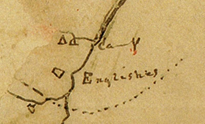
The map of this expedition held by the Texas General Land Office is remarkable for Fannin County history in that it shows “Englishes” and also, faintly below, “Gilberts”, as well as Bois d’Arc River, Red River and Warren. It seems there was an Indian camp north of Fort Inglish on the Bois d’Arc.
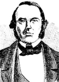
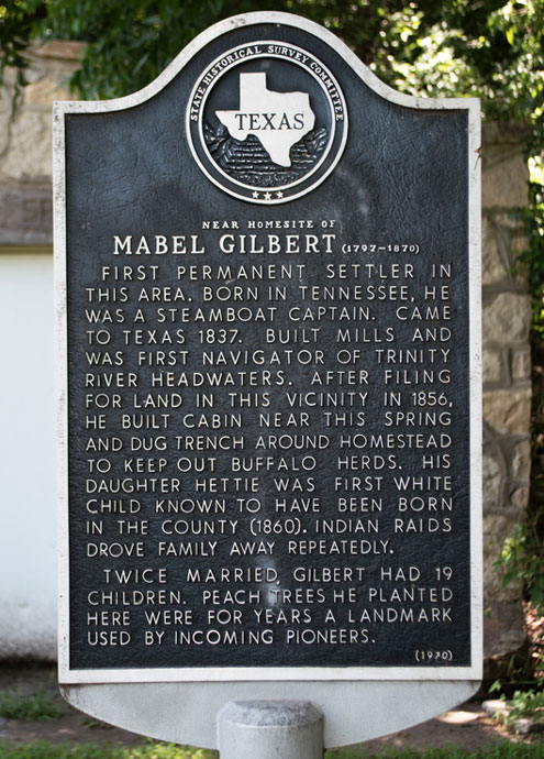
“Gilberts” was the residence of Mabel Gilbert, who in addition to Bailey Inglish was also an important early settler of Fannin County. He came to Fannin County in 1837, served as Justice of the Peace and a member of the first Fannin County Commissioner’s Court and helped draw up plans for the county’s first courthouse. He established the first horse-powered gristmill in Fannin County and in 1840 constructed an incline-wheel, ox-powered mill. Gilbert left Fannin County but returned in 1845. He later moved to Wichita County, where his grave is honored with an historical marker.
The entire large map can be seen at the website of the Texas General Land Office at https://medium.com/save-texas-history/sketch-of-col-cookes-military-road-expedition-from-red-river-to-austin-d7f94016963d
Lovers of history and old maps are greatly indebted to the wonderful work the Texas General Land Office has been doing for many years to save and make available to the public the map history of Texas.
The upper portion of this map will be on display at the offices of the Fannin County History Commission in the old Depot in Bonham, four blocks south of the Courthouse Square.